What it is
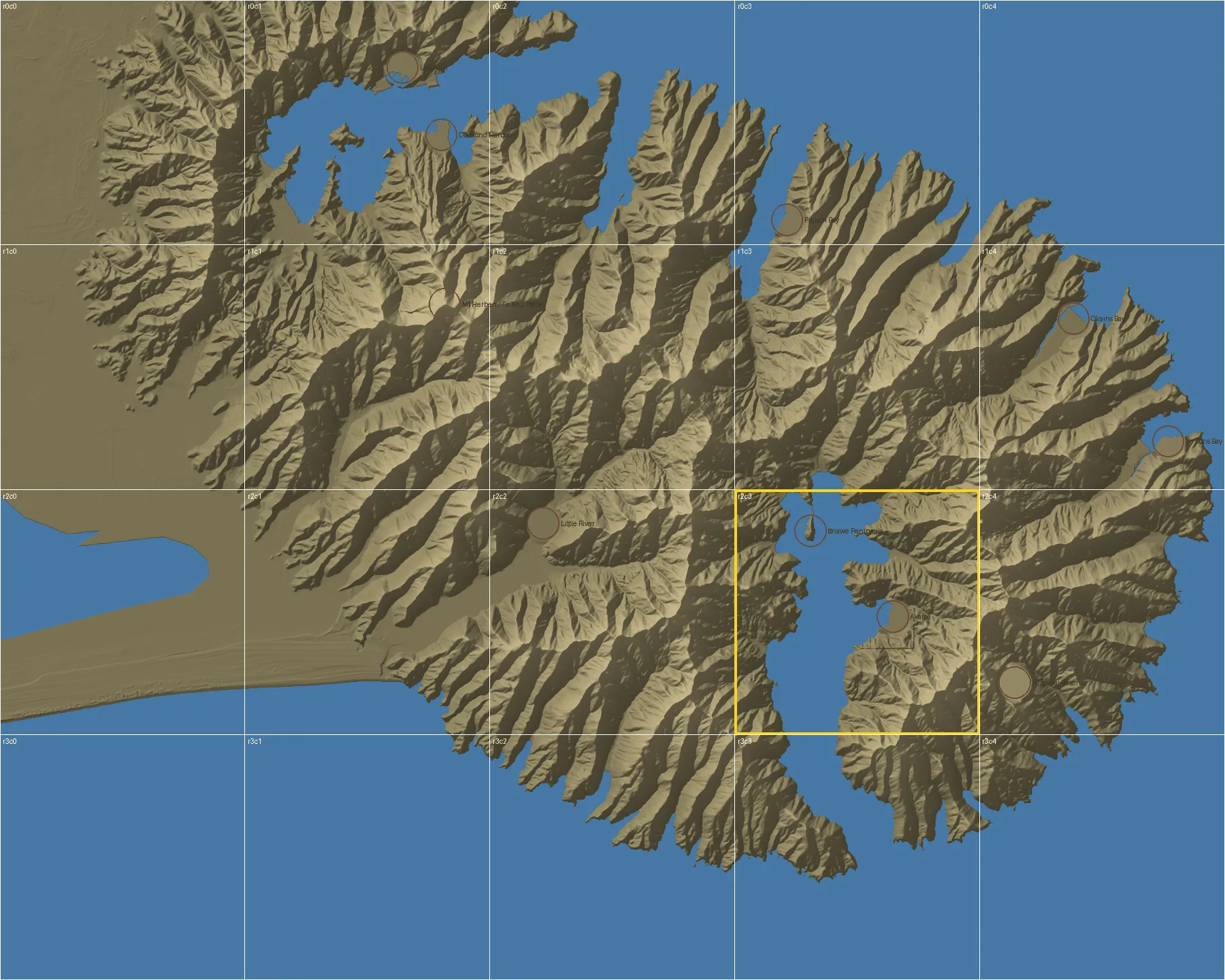
Two maps you can touch, printed in plastic and hung side by side:
- Banks Peninsula / Te Pātaka o Rākaihautū at 1:50,000: a metre wide, 20 tiles of 200 mm. The hills are exaggerated 2.5 times so you can feel the shape of the old volcano. Mount Herbert stands 46 mm tall.
- Akaroa town centre at 1:2,500, with all 1,099 buildings: 12 tiles, from the lighthouse to the French cemetery.
Small pockets mark places worth knowing about — the main wharf, the museum, the French cemetery, the lighthouse. Later, visitors could tap one to read about it.
How it works
Free, open elevation data from LINZ and Environment Canterbury (laser scans of the land, called LiDAR) goes into a small program we wrote. It cuts the area into tiles, adds the sea, the building outlines and the pockets, and writes watertight 3D files ready for the printer. Change a settings file and you can make a map of your own bay.
A test tile of the harbour takes about 8 hours and 181 g of plastic to print; the wharf tile about 5½ hours.
Why it matters here
It’s a way to learn the place with your hands, for a child, a visitor or someone with low vision. And it is meant to be printed in recycled plastic from the workshop — ideally, one day, from local bottle caps.
Where it stands
The pipeline works and both test tiles are sliced and checked. Nothing is printed yet. The code and the files will be published so any community can make its own.
Elevation data: LINZ and Environment Canterbury, CC BY 4.0.
Les plans sont gratuits — the plans are free.